Maps
Click on the below image thumbnails to view full size map in new page.

Dimensionstone Map of Nagaland

Mineral Map of Nagaland
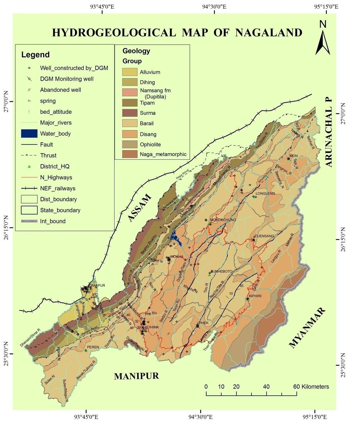
Hydrological Map of Nagaland

Geological Map showing Limestone Deposits of Nagaland
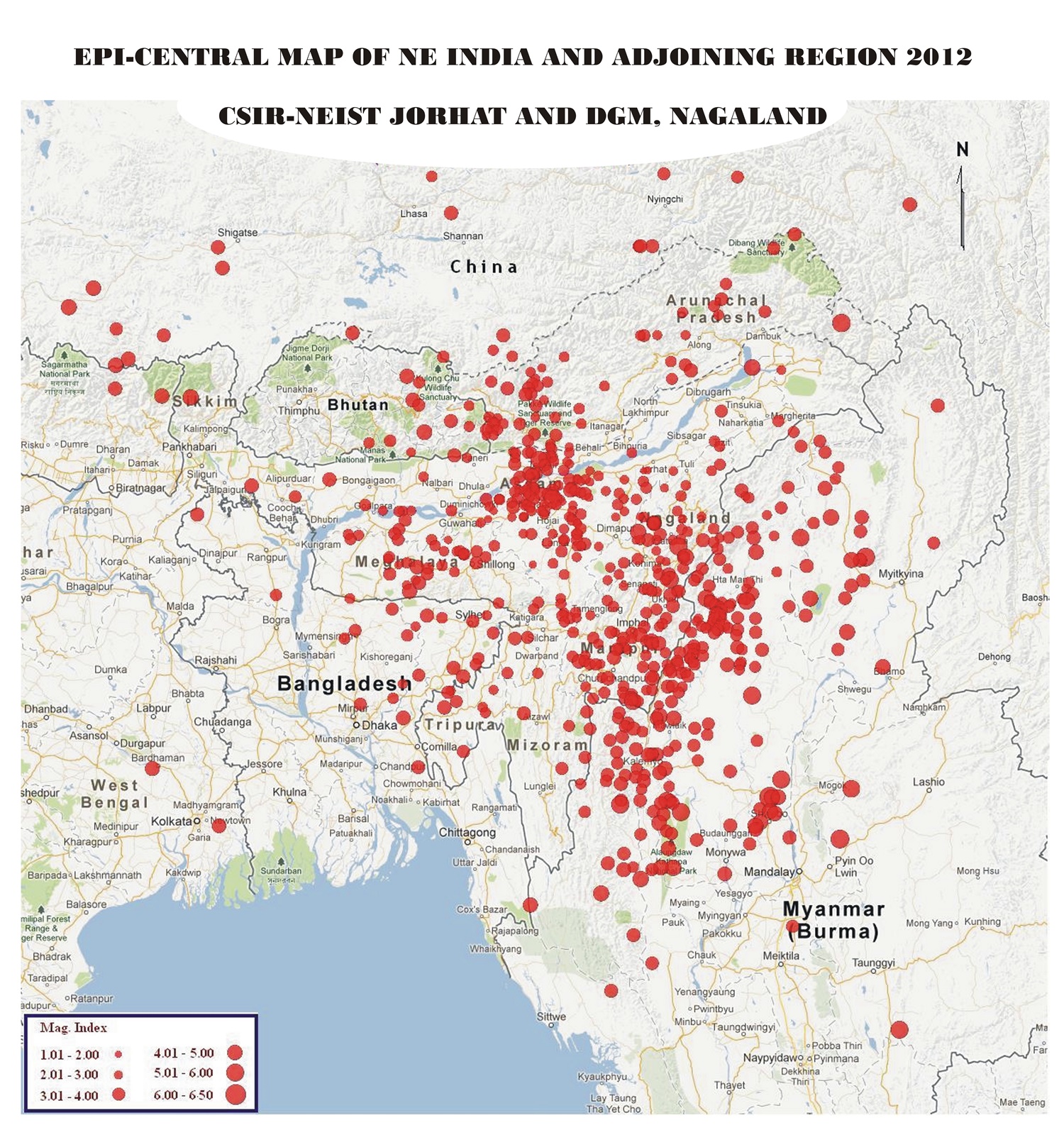
Epi-Centre of eathquake in NE India from 2012

Epi-Centre of eathquake in NE India from 2007-2011
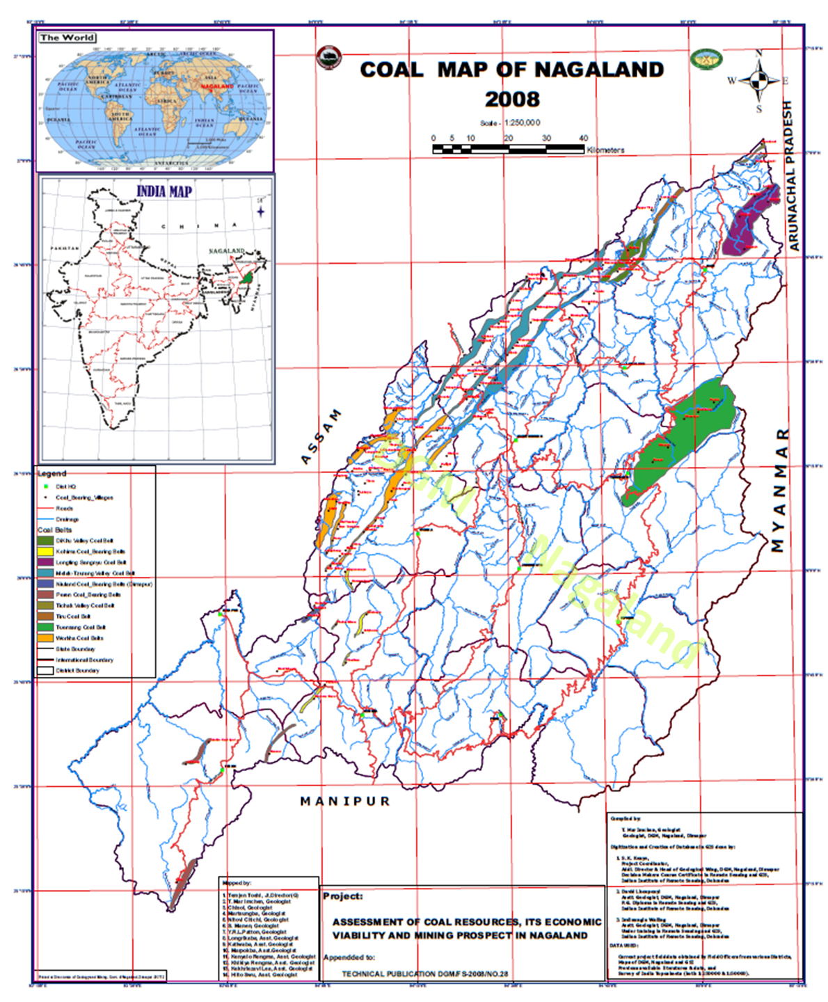
Coal Map of Nagaland